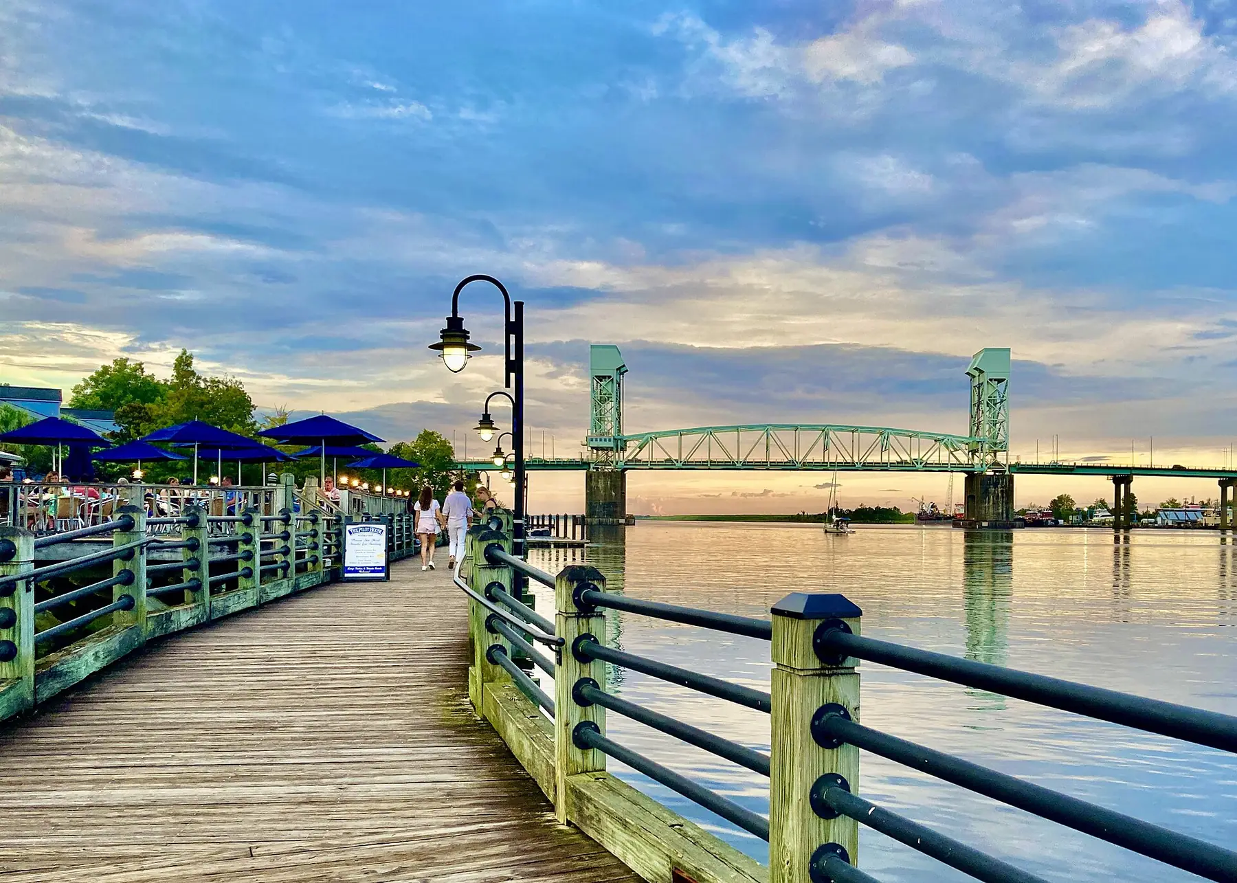
Wilmington's trails by distance: the 15-mile Cross-City Trail, Greenfield Lake's 4.8-mile path, the 1.75-mile Riverwalk, Halyburton and Mayfaire loops.
Last checked Oct. 11, 2026. Distances and trailheads come from the City of Wilmington’s walking and biking page, its park pages and the other pages linked below.
Wilmington is flat, and its trail network runs from the river downtown almost to the ocean. Here are the main routes by distance, with where to park and where the restrooms are. Park and trail details beyond these are on our parks and trails guide.
| Trail | Distance | Surface | Park at | Restrooms |
|---|---|---|---|---|
| Gary Shell Cross-City Trail | 15 miles | Paved and off-road | Halyburton, Empie or Anne McCrary parks | Halyburton and Empie parks |
| Greenfield Lake path | 4.8 miles | Paved | Greenfield Park, 1739 Burnett Blvd. | In the park |
| Mayfaire walking trail | 3-mile loop | Sidewalk, lit | Any Mayfaire lot | Conservation Way |
| Riverwalk | 1.75 miles | Boardwalk and walkway | Downtown decks and street | Riverfront Park |
| Halyburton Park loop | 1.3 miles | Paved, accessible | Halyburton Park, 4099 S. 17th St. | In the park |
Who to call
- Wilmington Parks and Recreation: 910-341-7852
- Halyburton Park: 910-341-0075
- Emergency: 911
Gary Shell Cross-City Trail: 15 miles
The city’s signature greenway runs 15 miles, paved and off-road, from James E.L. Wade Park to the Heide-Trask Drawbridge at the Intracoastal Waterway, passing through Halyburton Park and Empie Park and near the Cameron Art Museum, UNCW, Independence Mall and the Landfall Center, according to the city’s trail page. It will form part of the East Coast Greenway.
- Parking: Halyburton Park (4099 S. 17th St.), Empie Park (3405 Park Ave.) and Anne McCrary Park on Randall Parkway between Independence Boulevard and Kerr Avenue.
- Restrooms: Halyburton Park and Empie Park.
- Map: Cross-City Trail map (PDF).
- Etiquette: keep right and pass on the left, the city’s walking and biking page says.
Greenfield Lake: 4.8 miles
Greenfield Park, 1739 Burnett Blvd., has a 4.8-mile paved path for walking and biking, with trails winding around the cypress-lined lake, the city’s park page says. The 250-acre park also has restrooms, playgrounds, picnic shelters, an accessible fishing dock, a boat ramp with boat and kayak rentals, pickleball courts, the Alec Chambers Skate Park and the Rotary and Fragrance gardens. It is a year-round birding site. Fishing needs a license, though anyone under 16 with a licensed adult does not. 910-341-7852.
The Riverwalk: 1.75 miles
The Riverwalk “stretches 1.75 miles along the bank of the Cape Fear River,” from the foot of Nun Street in the south to the Isabel Holmes Bridge in the north, past parks, shops, restaurants and museums, with views of the Battleship. It connects to the River to Sea Bikeway, the East Coast Greenway and the Cape Fear Historic Byway. A multi-year decking replacement began in spring 2025, according to the city’s Riverwalk page. Parking is in nearby decks and on the street. More in our downtown and Riverwalk guide.
Halyburton Park: 1.3 miles
A 1.3-mile paved, accessible path circles Halyburton Park’s 60 acres of sandhills and longleaf pine and links to the Cross-City Trail. Restrooms, a playground and the nature center are on site. See our parks and trails guide.
Mayfaire’s walking trail: 3 miles
Mayfaire’s 3-mile, well-lit sidewalk loop runs past neighborhoods, preservation areas and the Town Center. Join it from Town Center Drive, Monument Drive, Destiny Way, Inspiration Drive or Main Street; public restrooms and water fountains are on Conservation Way, and security patrols 24 hours a day, according to the trail page.
Biking to the beach
The River to Sea Bikeway connects downtown Wilmington to Wrightsville Beach (route map), and the Cross-City Trail ends at the Heide-Trask Drawbridge. The Wilmington Urban Area MPO also publishes a citywide bike route map.
Rules
City parks and trails are open sunrise to sunset, dogs must be leashed and picked up after, and alcohol is banned except where designated, under the city’s park rules.
What this means for you
- Short on time: the 1.3-mile Halyburton loop or a stretch of the Riverwalk.
- Long ride: the full Cross-City Trail, 15 miles one way.
- After dark: Mayfaire’s loop is lit; city trails close at sunset.
Related: dog-friendly Wilmington, kids’ activities and free things to do.
Frequently asked questions
How long is the walk around Greenfield Lake?
The city describes a 4.8-mile paved path for walking and biking at Greenfield Park, winding around the lake. The park is at 1739 Burnett Blvd. and has restrooms.
How long is the Wilmington Riverwalk?
1.75 miles along the Cape Fear River, from the foot of Nun Street in the south to the Isabel Holmes Bridge in the north, according to the city.
Where does the Gary Shell Cross-City Trail start?
The 15-mile trail runs from James E.L. Wade Park to the Heide-Trask Drawbridge at the Intracoastal Waterway, through Halyburton and Empie parks. Parking is at Halyburton Park, Empie Park and Anne McCrary Park.
Can you bike from downtown Wilmington to Wrightsville Beach?
Yes. The River to Sea Bikeway connects downtown to Wrightsville Beach, and the Cross-City Trail ends at the Wrightsville Beach drawbridge.
Are dogs allowed on Wilmington trails?
Yes, on a leash, with owners picking up after them, under the city’s park rules.
Have your say